Digital City
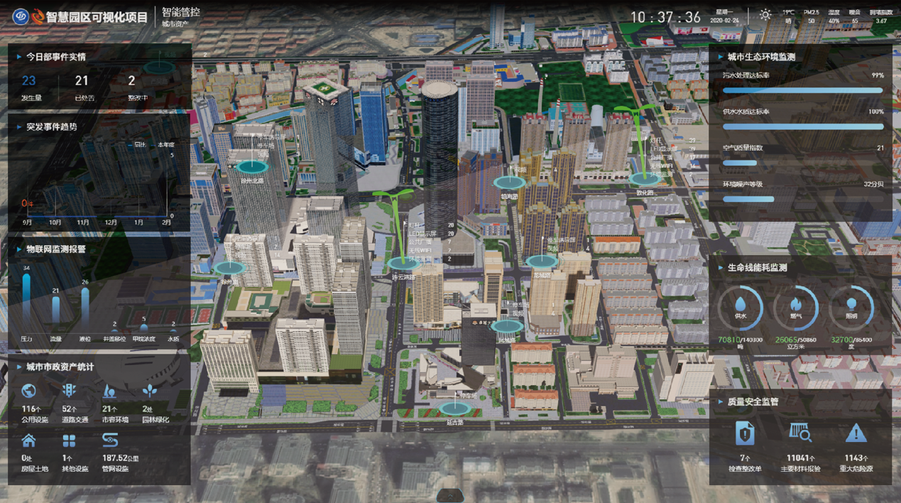
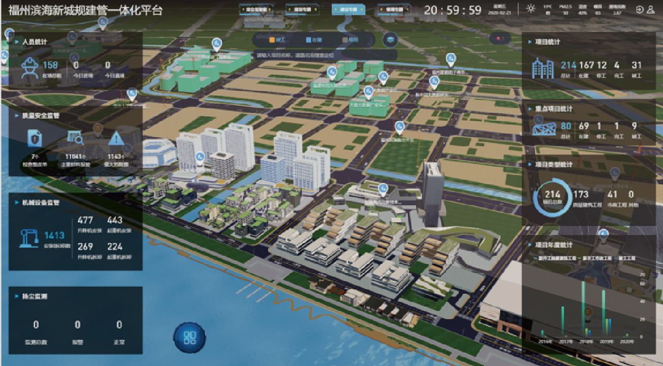
Glodon has been deeply engaged in the business of parks for many years, relying on its strong R&D and comprehensive technical capabilities to build its own (IP Protected) and the world's leading CIM platform. Within the platform end user has the capacity to receive digital consultancy, solutions and advanced product services for park planning, construction and operation management, and help clients build digital, online and intelligent digital twin parks. Glodon comprehensively explore and practice the model production of cities using data service models that aligns to an ecological system that will support certain business models. This will be achieved by accumulating big data, design , benign business model and ecological aggregation growth model of digital park business, accumulate park big data, algorithms to estimate precipitation amounts from data collected by remote sensing technologies. As a result the Digital Cities tool is the leader of platform service providers for digital city spatial infrastructure (CIM).


BIM + 3DGIS Fusion for Micro-Macro Integration
Automated access and seamless integration of 38 kinds of BIM data format and GIS data such as oblique photography data, point cloud data, terrain image, DLG, etc.; Lightweight processing technology for city-level big model data could be retrieved in real time to enhance "second-level experience" (showing ultra-speed). Furthermore, highly realistic photo-level rendering, with an average of more than 30 frames of movie-level smooth can be displayed. In addition, a self-developed technology system that supports plug-in-to WEB terminals and mobile terminal.
IOT Technology Integration for State Data Connection Integration
Supporting 10 million-level device links, control, and management, including large-scale device access, modeling and control.
Multi-Source Data Management for Spatio-Temporal Integration
Multi-source heterogeneous data integration of time, space, etc. supports the establishment of integrated spatio-temporal business data models; spatio-temporal big data analysis models and algorithms by generating graphs by utilizing intelligent analysis and data visualization of traffic, space, environment, emergency and other multi- scenarios.